ANAGRAM CITY
Throughout the history of mankind, space and place have been studied as part of a physical, mental or social dimension, but never of all, simultaneously. This lack of vision represents the main problem between the space conceived and lived in the construction of modern cities.
Ciudad Anagrama was created as the basis for the development of a new methodology for the study of urban space, involving interdisciplinary visions and Big Data visualization. Nine interactive maps (visions of space) are the result of each case study; providing relevant information for the design and conceptualization of our cities.
The urban space crisis will never stop until architects and urban planners begin to see things from a broader perspective, until we are willing to change the way we understand public space.
CASE 01 - PLAZA DE LA REPÚBLICA (México City)
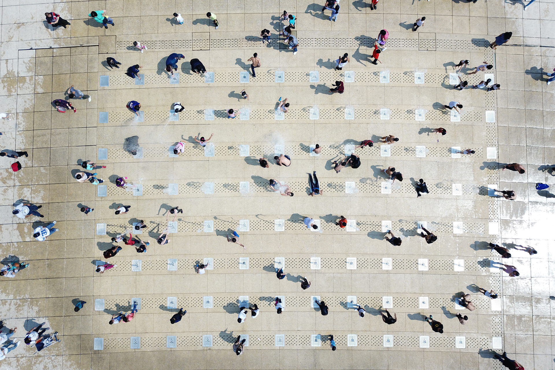
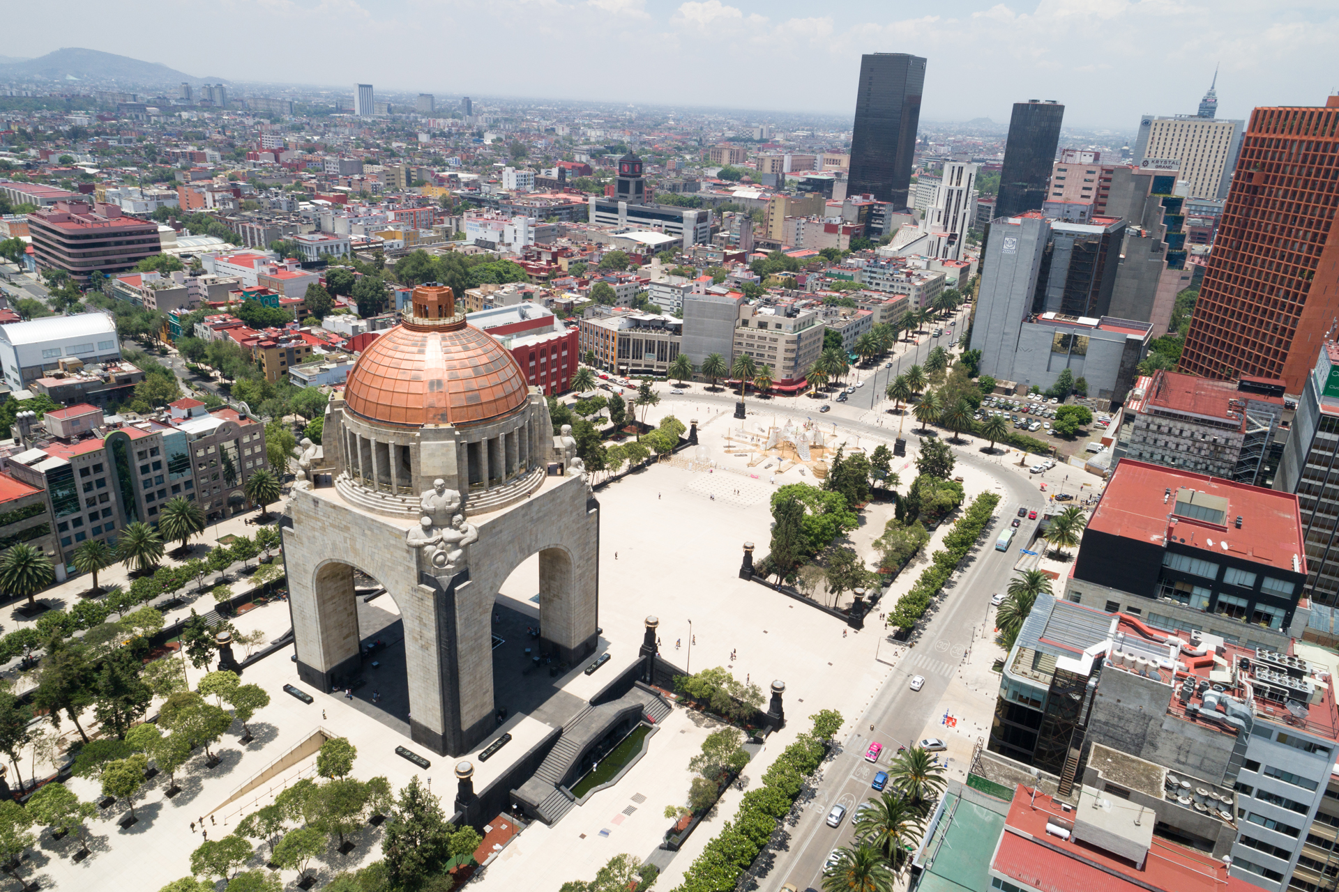
The Plaza de la República is considered the largest public square in Mexico City, it is located in the central part of the city and its surface covers 49,000.00 square meters (525,280.00 square feet) of urban territory, its daily occupation is approximately 3,500 people. and 6,000 on weekends.
For many years, this public space was underutilized until 2010, when it was renewed as part of the bicentennial festivities of Mexican independence. The renovation project contemplated the installation of 88 water jets in the center of the space that allow people to interact and give new life to the urban space.
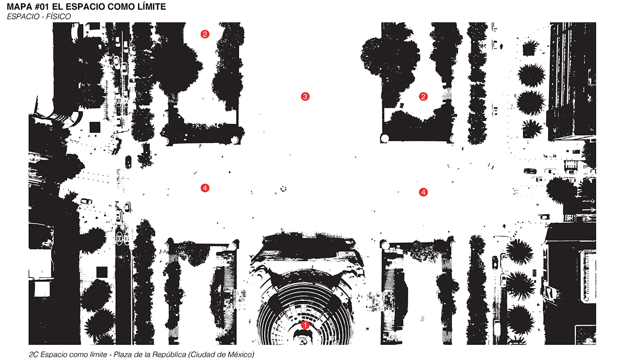
Map #01. SPACE AS LIMIT (Physical – Space)
We tend to think of space, as a set of 3D shapes and geometries that limit the flow of people and determine different types of uses. Connectivity and control between gaps become one of the most important aspects of this vision.
Disciplines such as architecture and urban planning operate from this type of vision. However, these physical limits limit and influence the forms of occupation that we give to urban space, but in fact, they do not determine them.
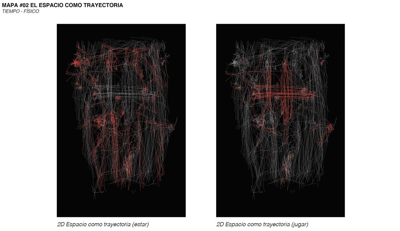
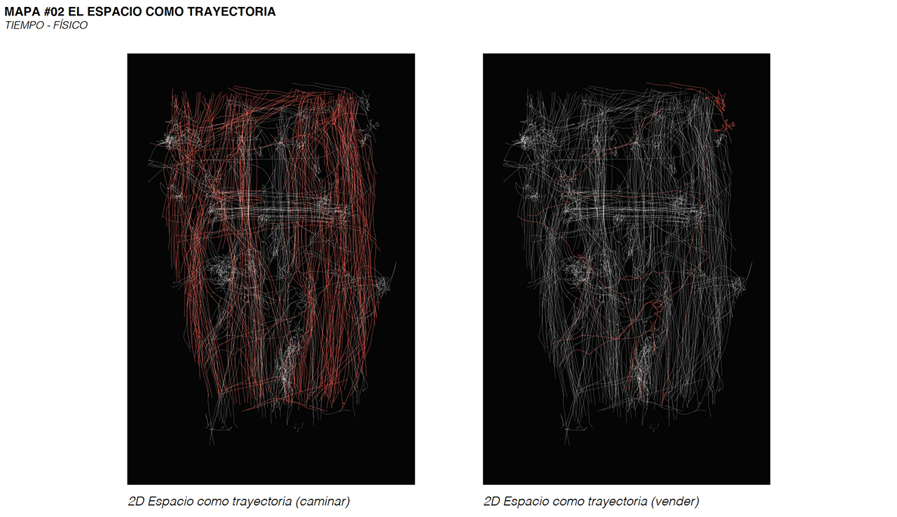
Map #02. SPACE AS TRAJECTORY (Physical - Time)
Trajectories are the ways in which physical time materializes in the world. The routes are inscriptions of the events that take place in the space.
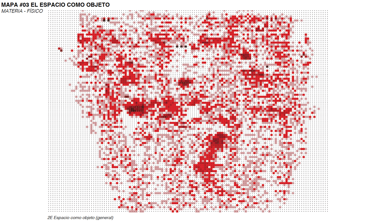
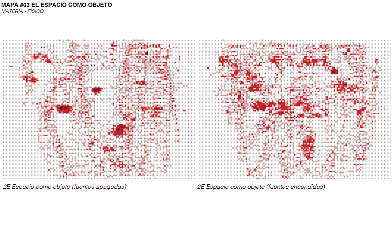
Map #03. SPACE AS AN OBJECT (Physical - Matter)
Physical matter is nothing more than objects in space, particularly moving objects, which have the ability to change positions. From this map we can determine the positions of the objects in space, and thus, determine the periods of their occupation.
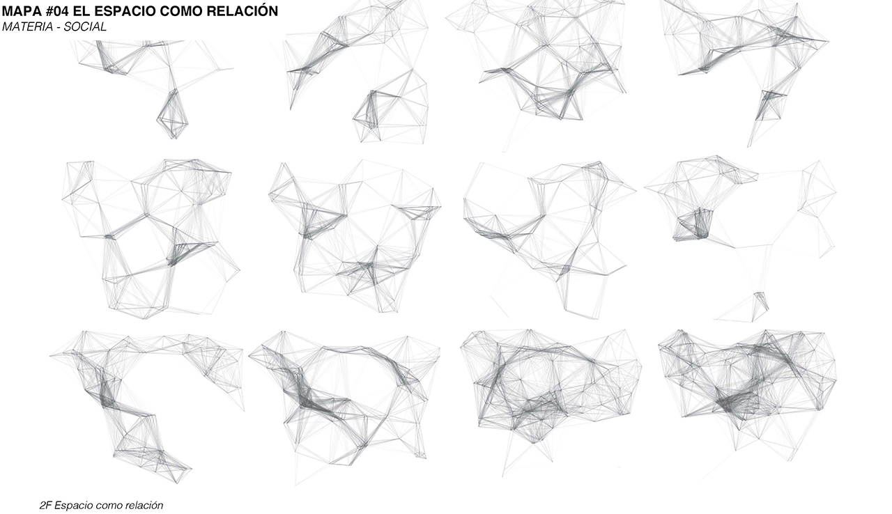
Map #04. SPACE AS RELATION (Social - Matter)
Creating urban density within our cities is an important way to reduce otherness (fear of the other) and a way to build collaboration. One way to measure this density is Proxemic, considered as one of the multiple forms of nonverbal communication. From making it visible we can use it to measure behavior and social interaction.
The configuration this map, people are measured with respect to the distance they maintain with others, to show the forms of density that the space has.
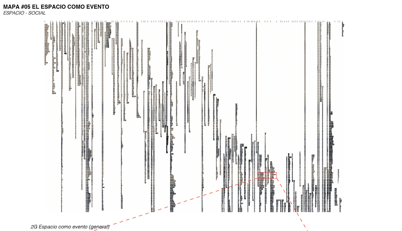
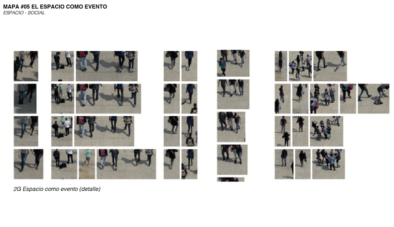
Map #05. SPACE AS AN EVENT (Social - Space)
Space only exists through action, and the event defines the place, but only momentarily. Events are the forms of manifestation of place in space.
This map is a form of cartography that shows the entire sequence of events that took place during a given period of time.
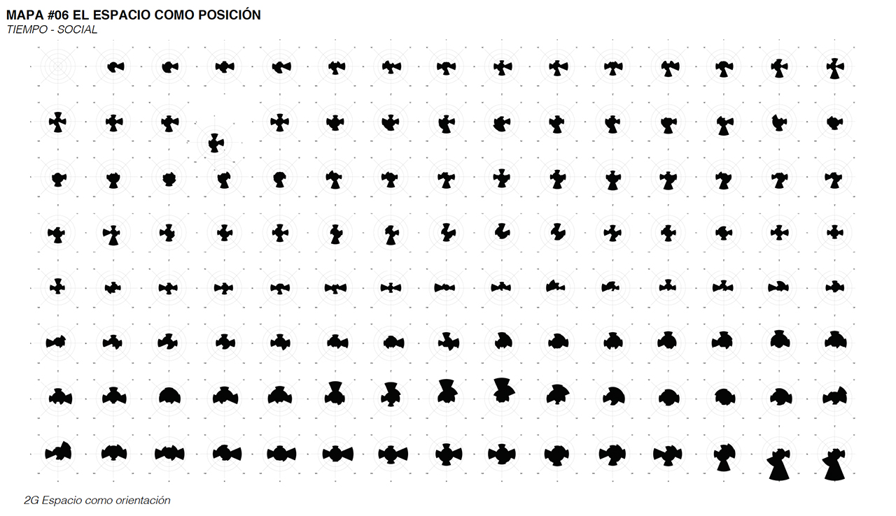
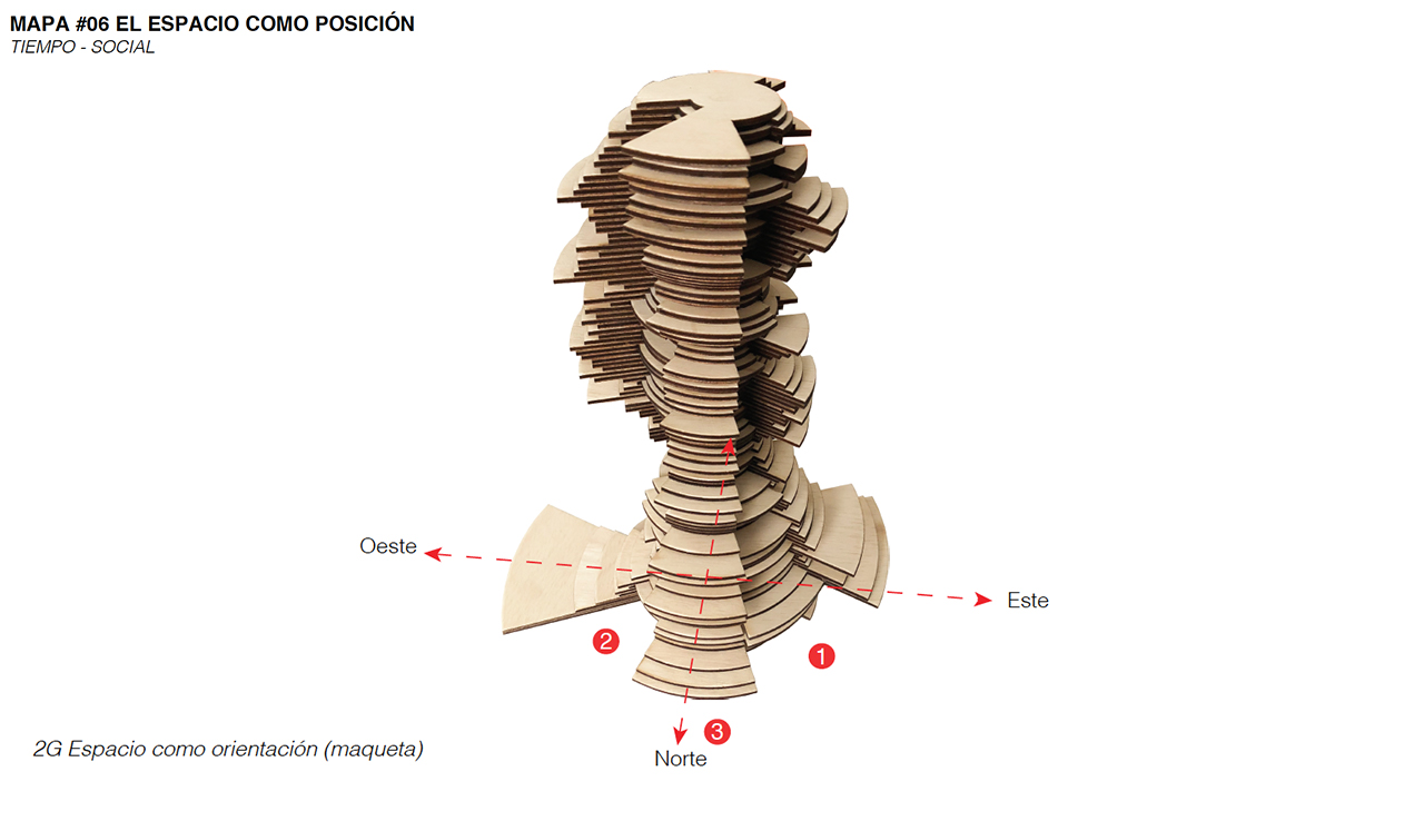
Map #06. SPACE AS ORIENTATION (Social - Time)
The way we orient ourselves in space determines the ways in which we construct meaning, this is directly related to the senses and their sensory fields. The space as orientation is a map transformed into a 3D graphic that shows information on how people are oriented in space, to determine subsequent maps.
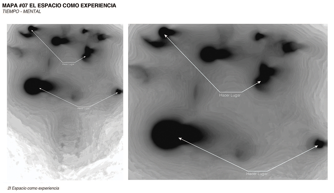
Map #07 SPACE AS EXPERIENCE (Mental - Time)
The experience of a space represents one of the most important aspects of how it is used; Our senses collect information creating perceptions of the world, which then our brain analyzes and transforms into emotions and sensations. Experience is the result of this process, which is used in the construction of meaning and the creation of place.
The experience map is created from the mapping of the sensory fields of sight, hearing and touch. The resulting topography shows the points of greatest perception (black points) where the creation of the “make place” process becomes visible.
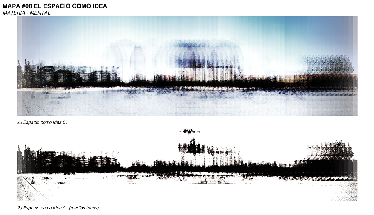
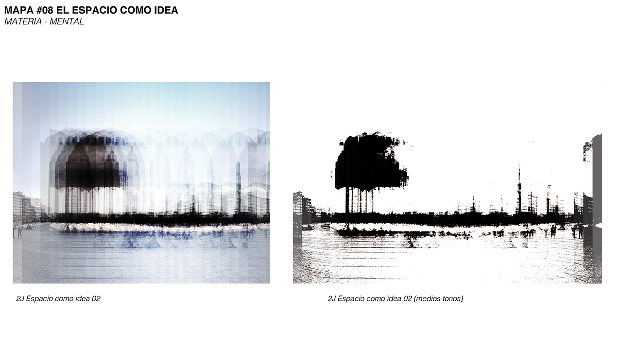
Map #08. SPACE AS AN IDEA (Mental - Matter)
As part of the process of meaning construction there is objective and subjective information, in other words, information that we can perceive and other that we unconsciously omit and invent. The place is created through the combination of experience and memory (individual and collective).
On this map it determines which part of the visual information is objective and which subjective, in the construction of meaning.
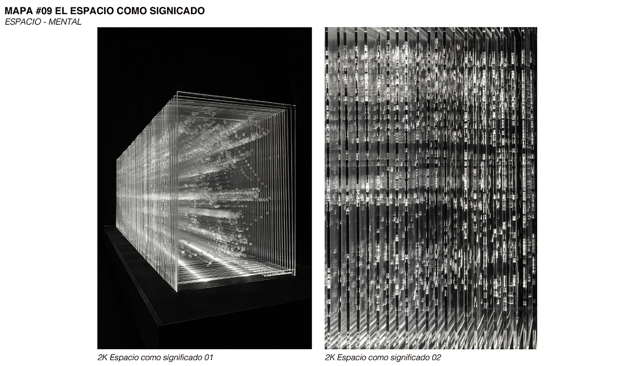
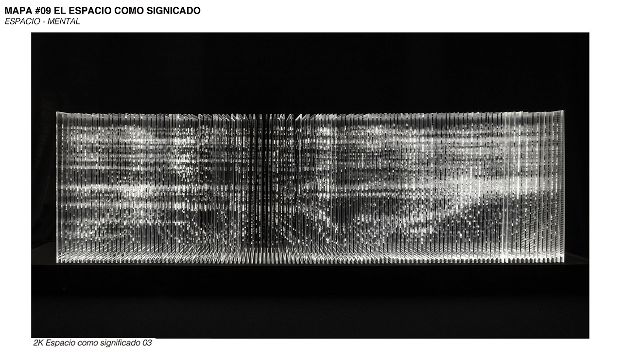
Map #09. SPACE AS MEANING (Mental - Space)
The place is nothing other than the assignment of meaning to a space. Making the urban social space visible is proof that we can replicate and influence it. This map of space as a meaning materializes the space-time worm as described by Einstein in his theory of Partial Relativity.
Project design: Eduardo Gorozpe Fernández
Design team: A-001 Taller de Arquitectura
Photography: Eduardo Gorozpe Fernández
